KCCA CELEBRATES GIS DAY AND SHOWCASES REMARKABLE ACHIEVEMENTS
PUBLISHED — 20th, November 2023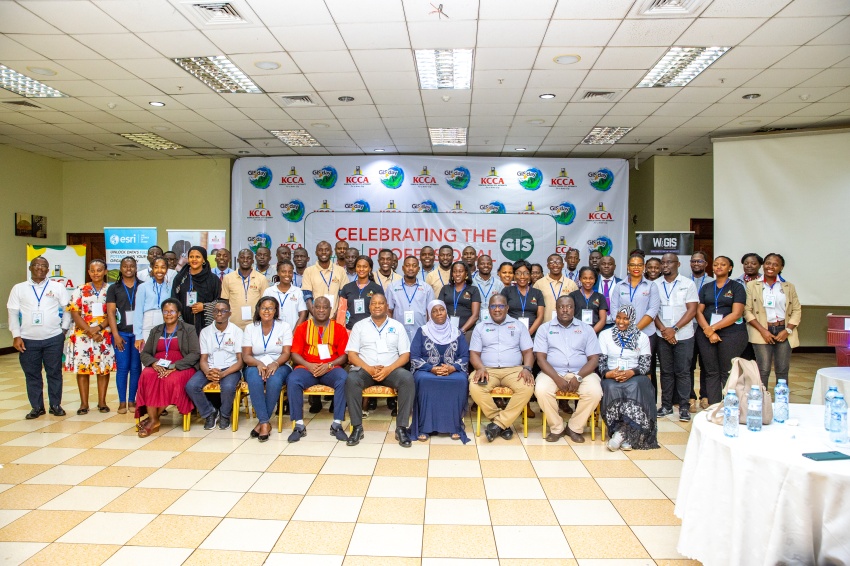
The Minister of Kampala Capital City and Metropolitan Affairs, Hajat Minsa Kabanda, has underscored the pivotal role of Geographic Information Systems (GIS) technology in revolutionizing Kampala city's management and services.
Kabanda made the remarks during the GIS Day Celebrations that were, organized by Kampala Capital City Authority (KCCA), on Friday at the Imperial Royale Hotel in Kampala.
The theme of the day, "Celebrating the GIS Professionals," resonated through the presentations and discussions, with a particular focus on the transformative impact of GIS on urban planning, disease control, and overall service delivery.
The event brought together GIS professionals, government officials, and stakeholders. Kabanda, emphasized the power of GIS in managing infrastructure, containing diseases, and improving service delivery
"Through GIS, we have successfully managed and planned infrastructure, contained diseases, conducted efficient land use planning, ensured crowd control, and significantly enhanced revenue collection," she stated.
The Deputy Executive Director of KCCA Eng David Luyimbazi, spoke passionately about the importance of connecting GIS technology information with the layman.
"The day we disconnect our information from the layman, we lose it. GIS is a powerful tool that should be harnessed to monitor the movement of cesspool emptier, track garbage collection, and ultimately improve service delivery in the city," he urged.
Flavia Zabali, representing KCCA's GIS technology department, highlighted the department's role in supporting various city functions with spatial data.
"GIS is a tool that enables us to understand locations, plan public transportation, monitor disease outbreaks, and survey the city for effective management," she emphasized.
One of the significant achievements showcased during the celebration was the impact of GIS on revenue collection.
"Through the City Address Model-Computer Aided Mass Valuation (CAM-CAMV), our property rates collections have increased from sh7.72 billion in 2011/2012 to sh43.5 billion in 2021/2022. This is attributed to our ability to precisely locate properties, implement road naming, house numbering, and improve overall navigation within the city," Zabali explained.
GIS supports decision making and policy making by enabling spatial analysis, data visualization, and scenario modeling
As the city strives to become a Smart City, the role of GIS in understanding the distribution of taxpayers, planning public infrastructure, and responding to potential disease outbreaks has become increasingly evident.
The celebration served as a call to action for professionals to further integrate GIS into their work, emphasizing its potential to enhance the quality of life for Kampala's residents and streamline city management.
GIS Day is a worldwide event that celebrates the technology of Geographic Information Systems (GIS). Ralph Nader inspired GIS Day as a day for geography awareness. The first-ever GIS Day was held on November 19, 1999, during Geography Awareness Week from November 14-20, 1999.
News & Announcements

13th, June 2026

6th, June 2026

4th, June 2026

29th, May 2026

26th, May 2026

25th, May 2026

25th, May 2026

21st, May 2026

20th, May 2026

19th, May 2026


Development partners